Earth is divided into seven commonly recognized continents, each with its own geographical features, landscapes, climates and ecosystems. From the enormous mountain ranges of Asia to the frozen environment of Antarctica, every continent contributes to the geographical diversity of our planet.
Understanding the continents helps explain how Earth’s landmasses are organized and how natural environments differ across regions. It also provides a foundation for learning about countries, oceans, mountains, rivers and global climate patterns.
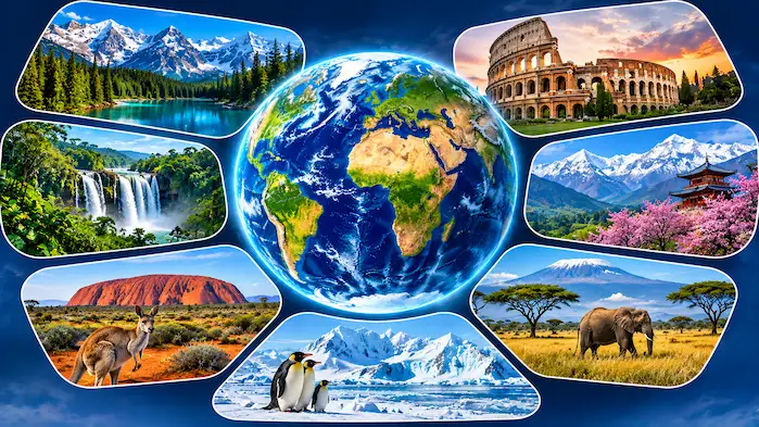
This guide explores all seven continents, their locations, physical characteristics and important geographical features.
What Is a Continent?
A continent is one of Earth’s major landmasses. Continents are large geographical regions separated by oceans, seas and, in some cases, conventional geographical boundaries.
The seven-continent model is widely used in schools and educational resources. It recognizes Asia, Africa, North America, South America, Antarctica, Europe and Australia.
However, continent classifications can vary. Some geographical systems combine Europe and Asia into Eurasia, while others use different continental models.
Each continent contains several geographical regions with distinct physical and environmental characteristics.
The Seven Continents of the World
1. Asia
Asia is the largest continent by land area and population. It occupies a large part of the Eastern and Northern Hemispheres and extends from the Arctic region to tropical areas near the Equator.
Asia contains a remarkable variety of geographical environments. Its northern regions experience extremely cold conditions, while Southeast Asia includes tropical rainforests and islands.
Important geographical features include:
- Himalayan Mountains: A major mountain system containing Mount Everest, the world’s highest mountain above sea level.
- Tibetan Plateau: An extensive high-elevation region often called the Roof of the World.
- Gobi Desert: A large desert extending across parts of Mongolia and China.
- Yangtze River: The longest river in Asia.
- Ganges River: An important river system in South Asia.
Asia also contains major lakes, forests, grasslands and coastal environments. Its geographical diversity supports a wide range of ecosystems and human settlements.
2. Africa
Africa is the second-largest continent by land area. It is crossed by the Equator and includes tropical, subtropical, desert and Mediterranean climate regions.
The Sahara Desert occupies a large portion of northern Africa. South of the Sahara, the continent contains grasslands, tropical forests and other natural environments.
Important geographical features include:
- Sahara Desert: The largest hot desert in the world.
- Nile River: A major river system in northeastern Africa.
- Congo Basin: A region containing extensive tropical rainforest.
- Lake Victoria: One of Africa’s largest freshwater lakes by surface area.
- Mount Kilimanjaro: Africa’s highest mountain.
Africa also contains the East African Rift System, a large geological feature associated with tectonic activity and the formation of valleys and lakes.
3. North America
North America is located mainly in the Northern and Western Hemispheres. It extends from the Arctic regions in the north to Central America in the south.
The continent contains mountains, plains, forests, deserts, lakes and extensive coastlines.
Its major geographical features include:
- Rocky Mountains: A major mountain system in western North America.
- Appalachian Mountains: An older mountain range in the eastern region.
- Great Plains: An extensive area of relatively level grassland.
- Great Lakes: A group of five major freshwater lakes.
- Mississippi River: An important river system in the central United States.
North America’s climate varies from polar conditions in the far north to tropical conditions in parts of Central America.
4. South America
South America is located mainly in the Southern Hemisphere. It is known for its extensive rainforest, high mountain ranges, grasslands and river systems.
The Andes Mountains extend along much of the western side of the continent. The Amazon River flows through a large drainage basin that includes extensive tropical rainforest.
Important geographical features include:
- Andes Mountains: The longest continental mountain range above sea level.
- Amazon River: One of the world’s largest rivers by water discharge.
- Amazon Rainforest: A vast tropical rainforest with exceptional biodiversity.
- Atacama Desert: An extremely dry region in western South America.
- Patagonia: A geographical region covering parts of southern Argentina and Chile.
The continent also contains the Brazilian Highlands, extensive wetlands and important freshwater ecosystems.
5. Antarctica
Antarctica surrounds the South Pole and is the coldest continent on Earth.
Most of its surface is covered by a thick ice sheet. Its environment includes glaciers, ice shelves, frozen mountains and extensive polar landscapes.
Antarctica has no permanent native population. However, several countries operate scientific research stations where researchers study ice, climate, atmospheric conditions and wildlife.
The continent supports animals adapted to cold marine environments, including penguins, seals and various seabirds.
Antarctica is also classified as a polar desert because its interior receives very little precipitation.
6. Europe
Europe is located mainly in the Northern Hemisphere and forms part of the larger Eurasian landmass.
Although it is relatively small compared with Asia and Africa, Europe contains a diverse collection of geographical features.
Important features include:
- Alps: A major mountain system in central Europe.
- Pyrenees: Mountains forming a natural boundary between Spain and France.
- Carpathian Mountains: A mountain range extending across central and eastern Europe.
- North European Plain: A broad lowland region.
- Danube River: A major river that flows through several European countries.
Europe also contains numerous peninsulas, islands, lakes and coastal regions.
7. Australia
Australia is the smallest continent by land area in the commonly used seven-continent model.
It includes extensive dry interior regions, coastal environments, forests and mountain systems.
Important geographical features include:
- Great Dividing Range: A major mountain system in eastern Australia.
- Great Barrier Reef: A large coral reef system located off northeastern Australia.
- Australian Outback: A broad region covering much of the country’s interior.
- Lake Eyre: Also known as Kati Thanda–Lake Eyre, an important inland salt lake.
Australia has distinctive wildlife and ecosystems that developed through long periods of geographical isolation.
Comparing the Seven Continents
| Continent | General geographical characteristic |
|---|---|
| Asia | Largest continent by land area |
| Africa | Extensive deserts and tropical environments |
| North America | Large mountain systems and freshwater lakes |
| South America | Andes Mountains and Amazon Basin |
| Antarctica | Polar ice-covered environment |
| Europe | Extensive plains, peninsulas and mountain ranges |
| Australia | Smallest continent by land area |
These characteristics provide a simple introduction. Each continent contains much more geographical diversity than a single description can capture.
How Continents Influence Earth’s Geography
Continents influence the distribution of ecosystems, climate patterns, freshwater resources and human settlements.
Their size and position affect how sunlight, atmospheric circulation and ocean currents interact with different regions.
For example, large mountain ranges can influence rainfall by forcing moist air to rise. Extensive forests support biodiversity and influence regional water cycles. Coastal areas experience different environmental conditions from inland regions.
Continental geography also helps explain the distribution of natural resources and the development of transportation routes and settlements.
Frequently Asked Questions
How many continents are there?
The commonly used model recognizes seven continents: Asia, Africa, North America, South America, Antarctica, Europe and Australia.
Which is the largest continent?
Asia is the largest continent by land area and population.
Which is the smallest continent?
Australia is the smallest continent by land area in the seven-continent model.
Which continent is the coldest?
Antarctica is the coldest continent on Earth.
Which continent contains the Amazon Rainforest?
The Amazon Rainforest is located in South America.
Are Europe and Asia connected?
Yes. Europe and Asia form one continuous landmass commonly called Eurasia. Their division into two continents is based largely on geographical and historical conventions.
Explore Earth’s Continents
The seven continents provide a useful framework for understanding Earth’s major landmasses. Each has distinct physical features, climate conditions and ecosystems.
Learning about continents also helps explain how different regions connect through oceans, mountain systems, rivers and natural environments. Exploring their geographical characteristics is an important step toward developing a broader understanding of our planet.